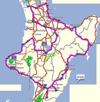
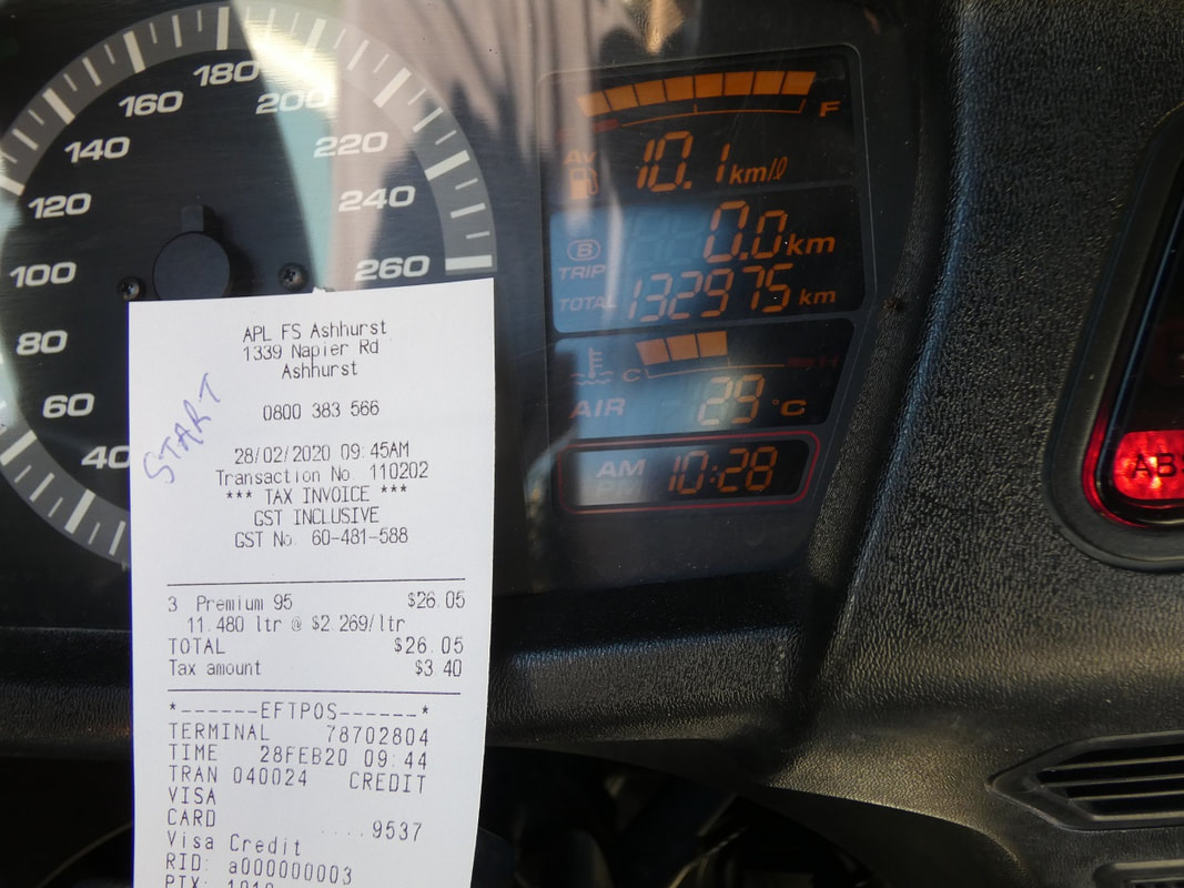
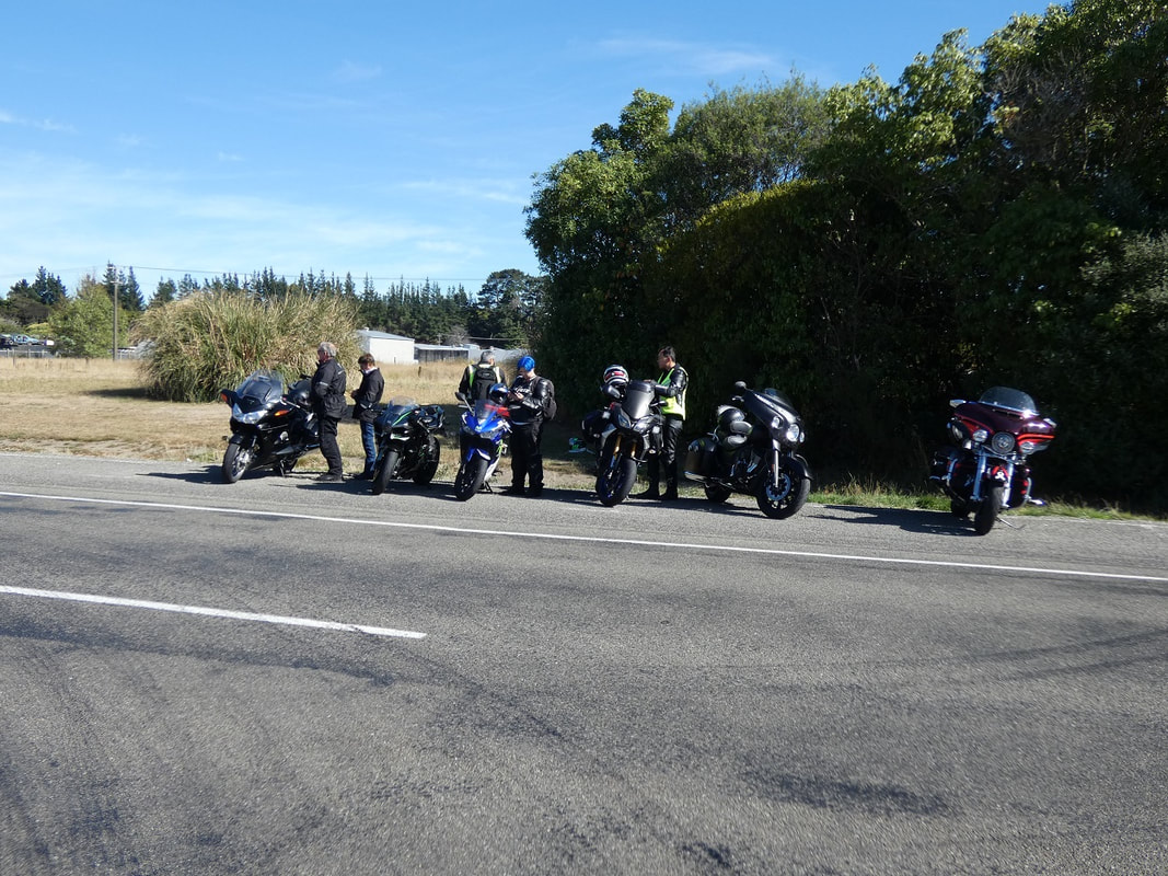
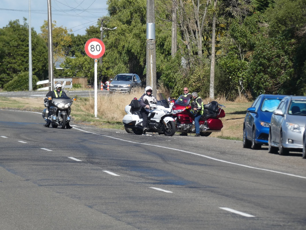
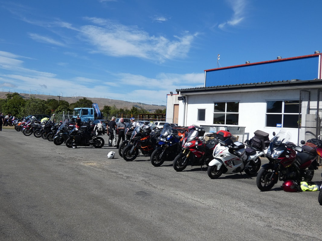
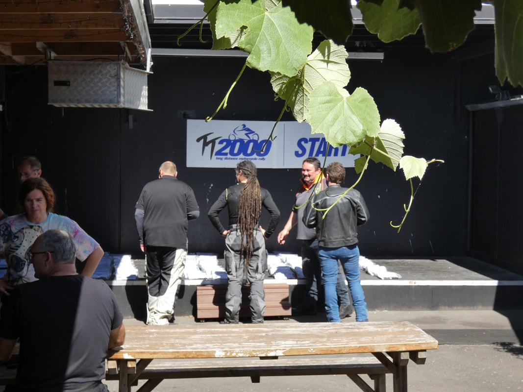
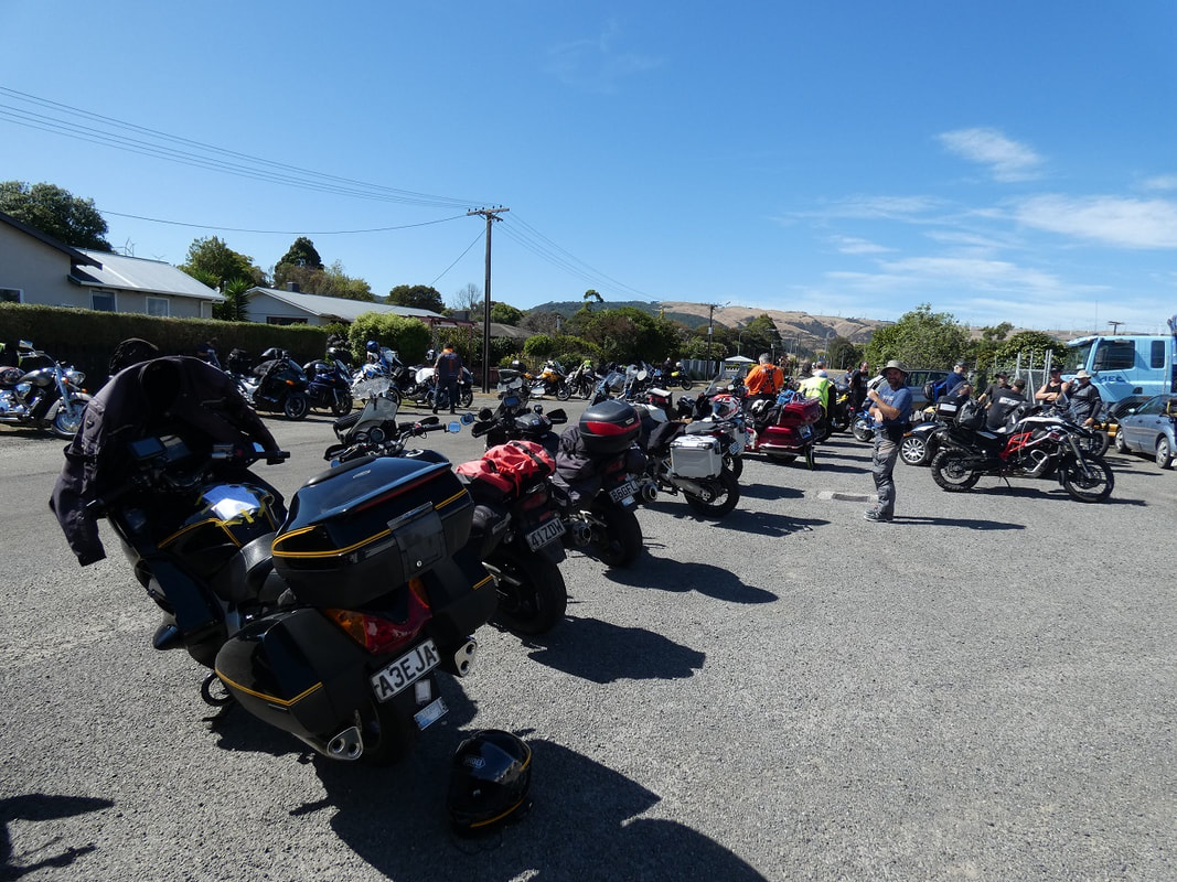
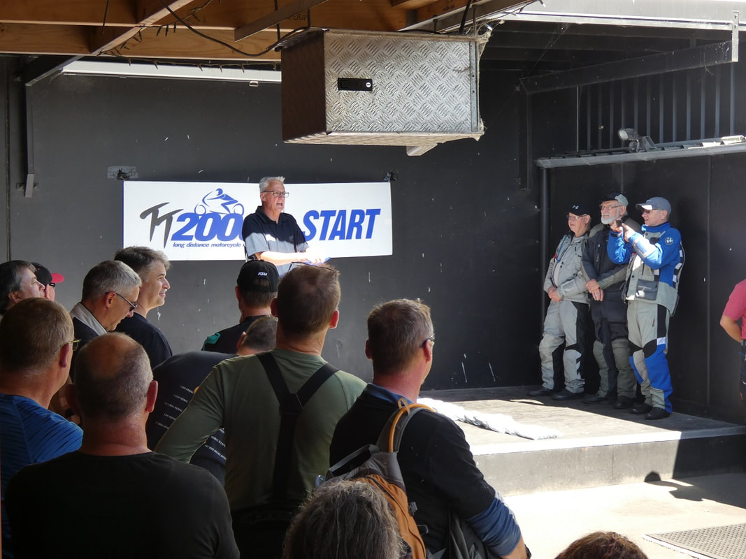
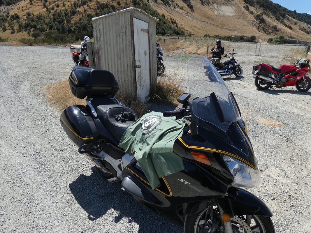
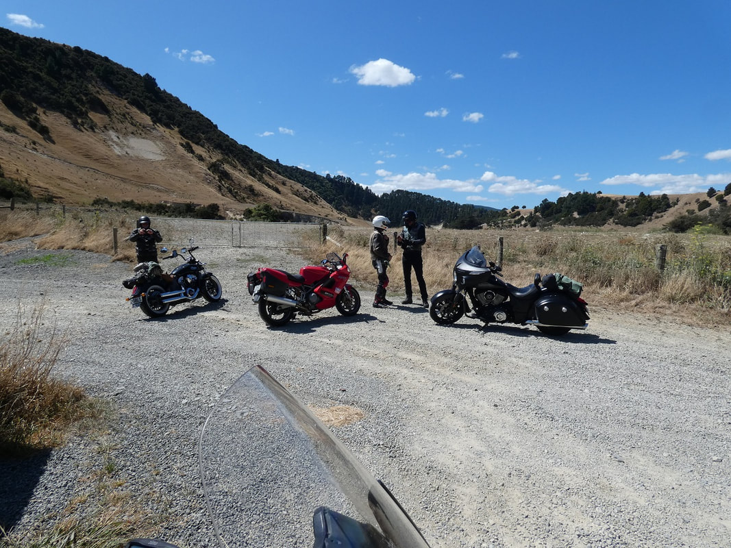
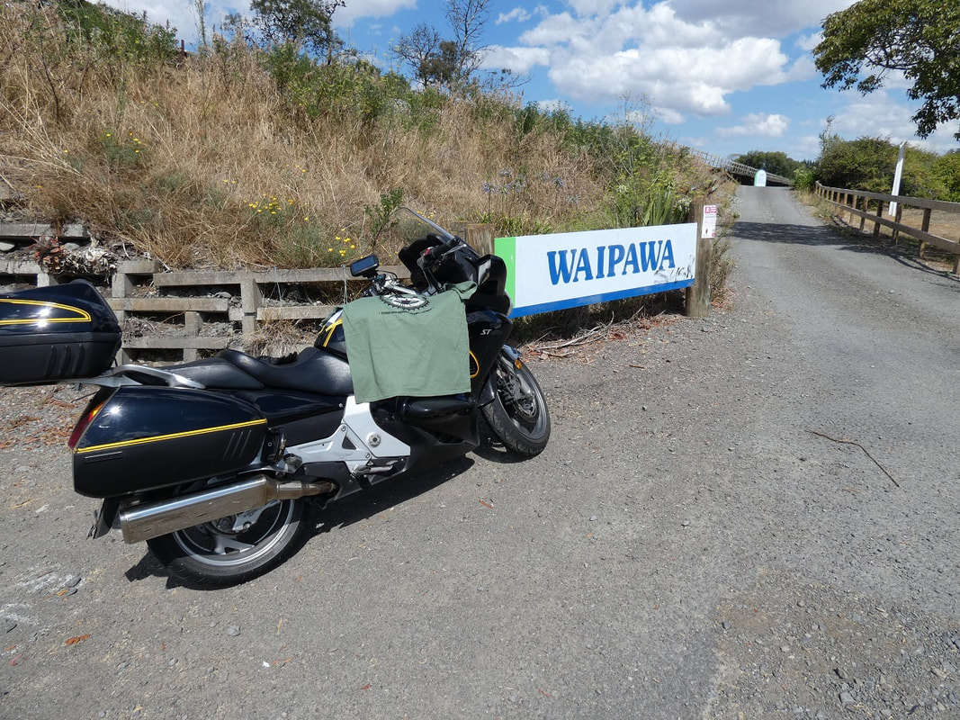
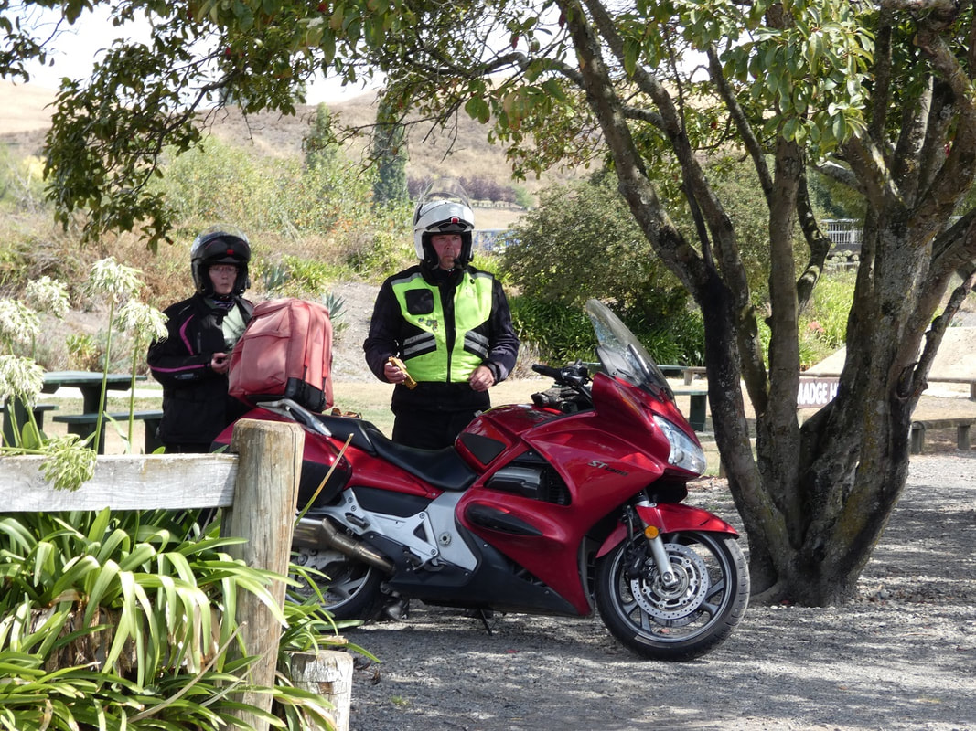
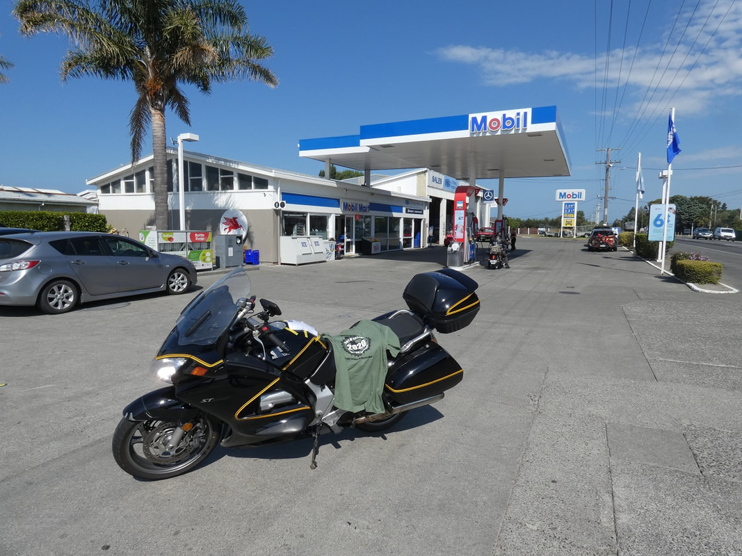
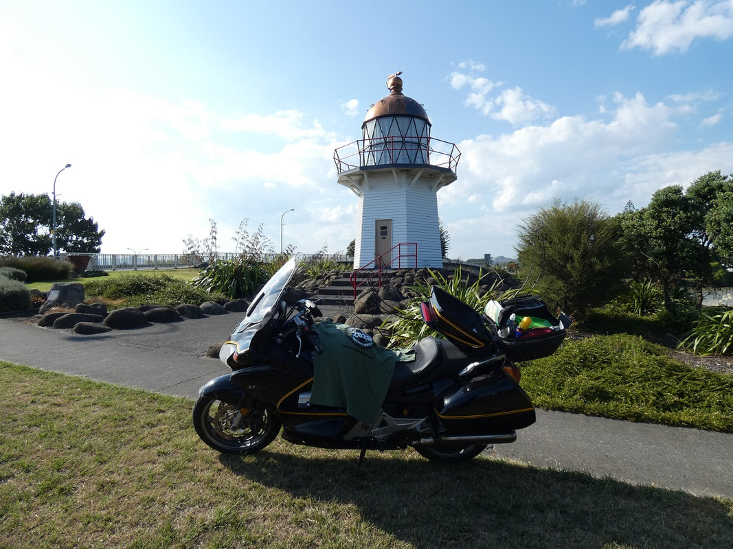
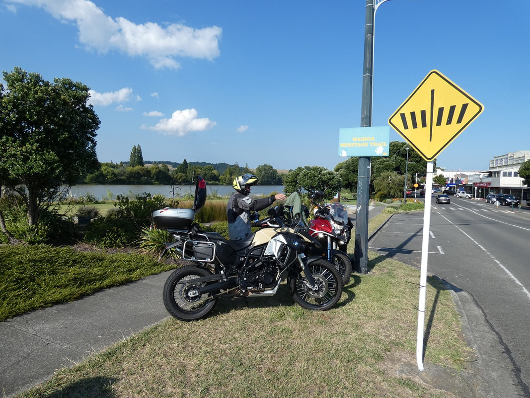
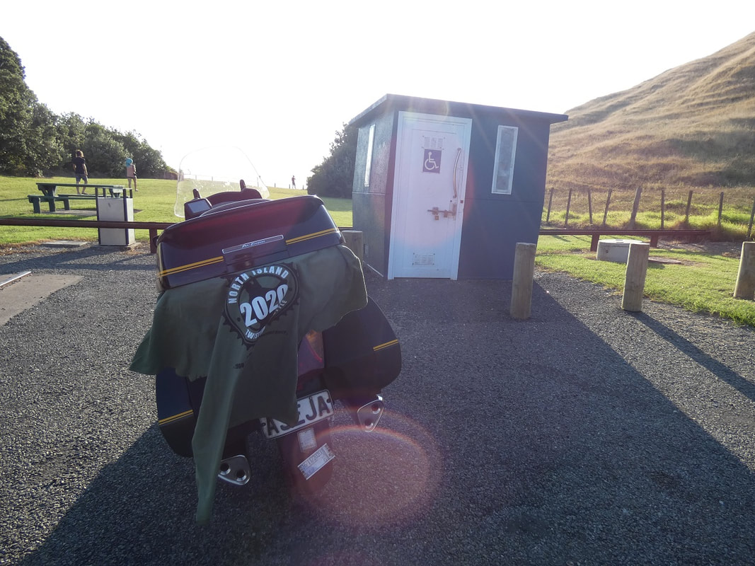
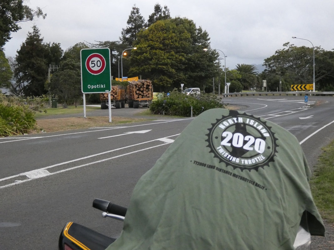
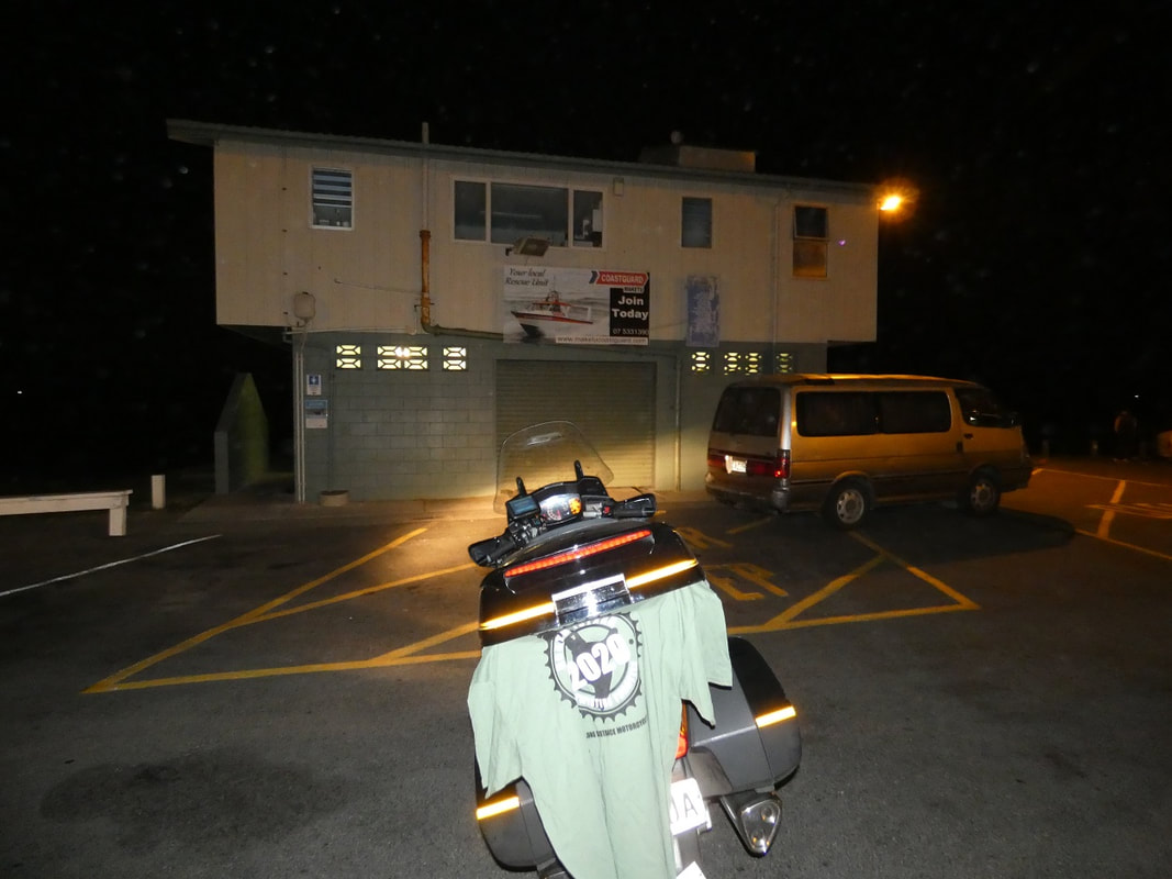
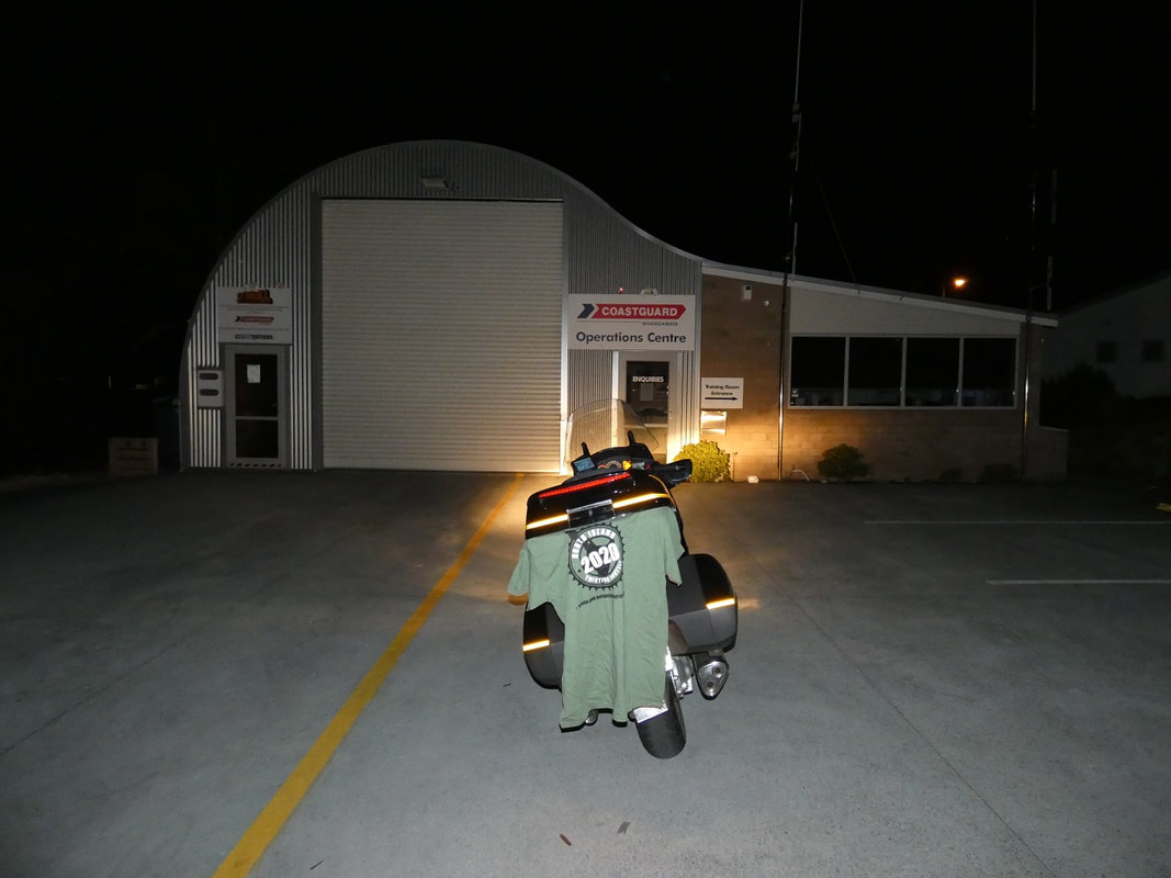
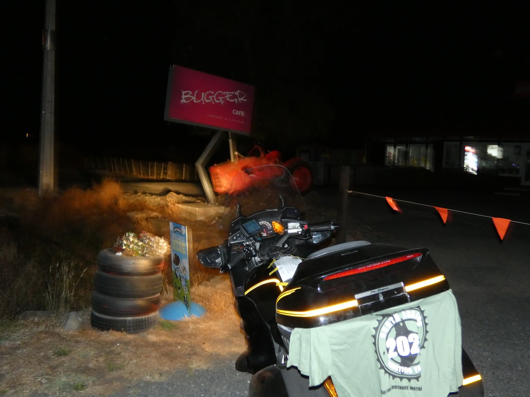
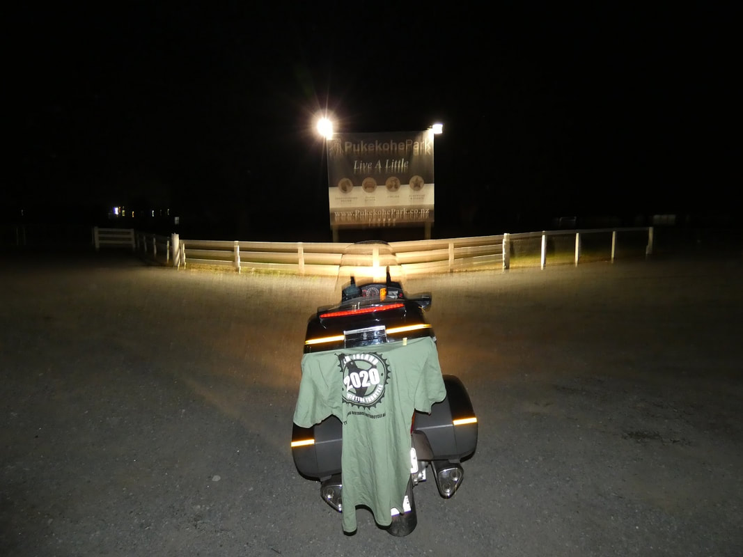
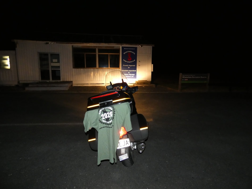
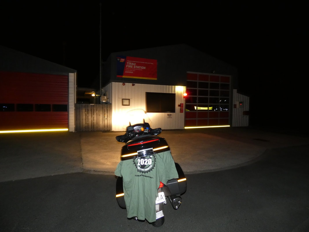
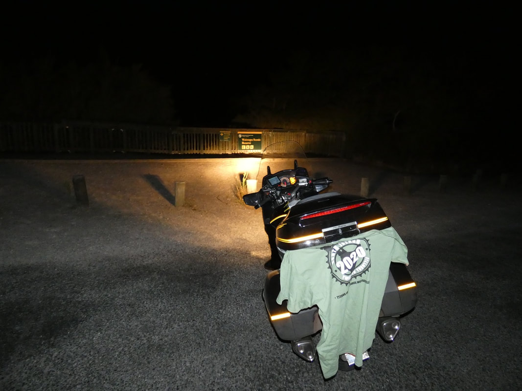
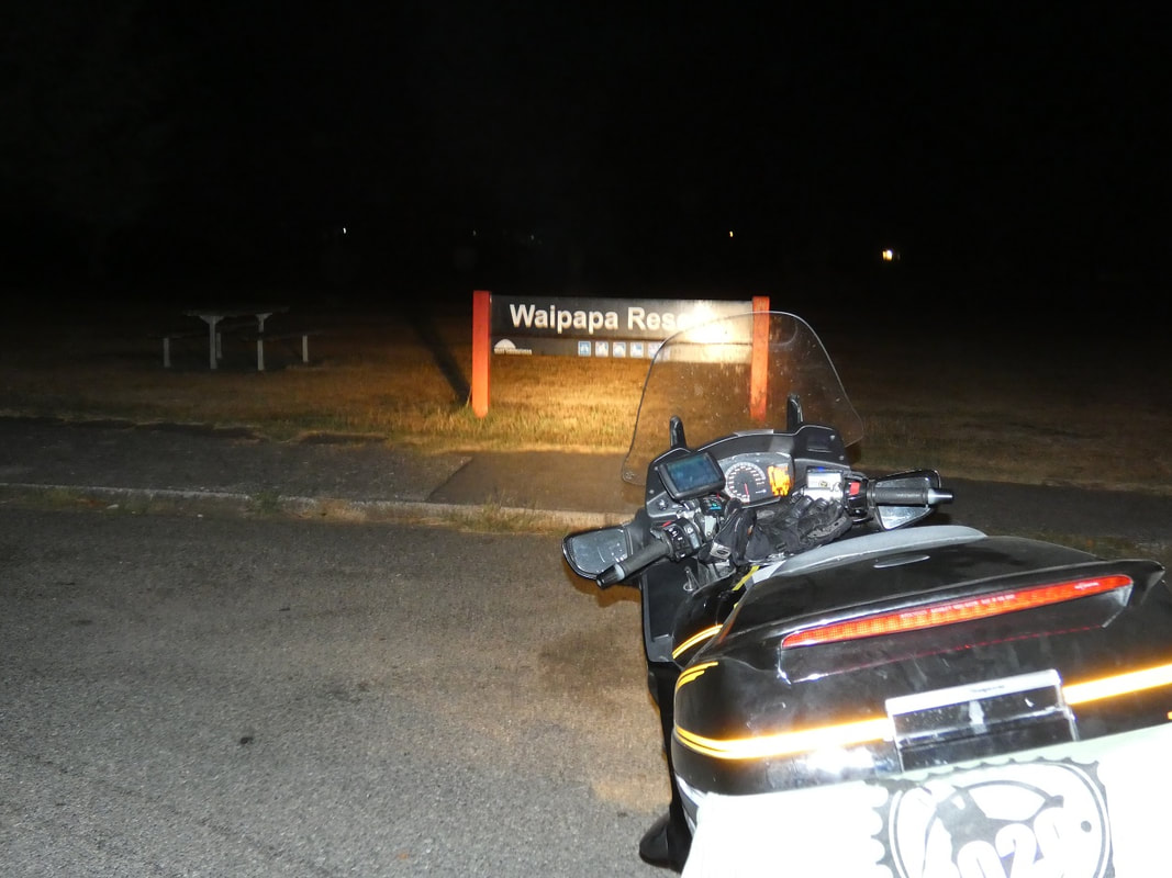
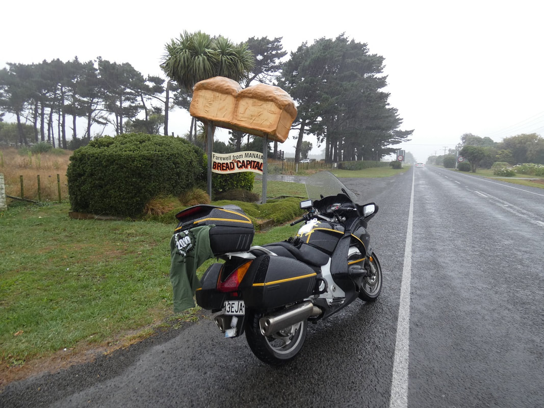
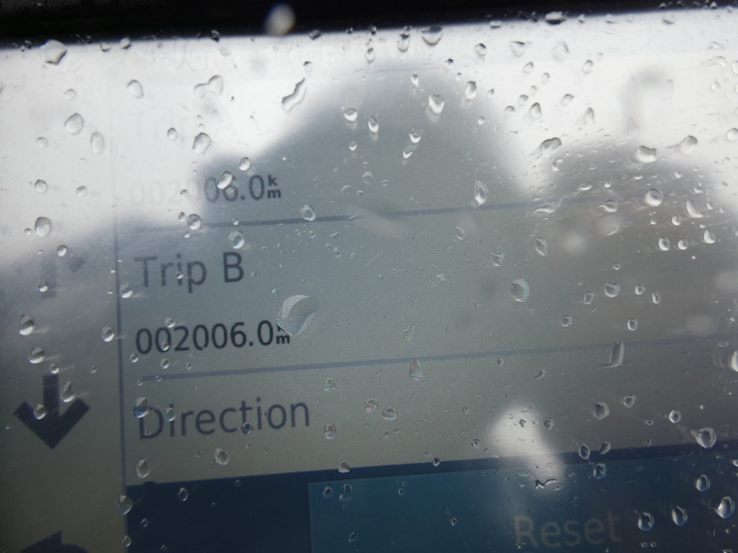
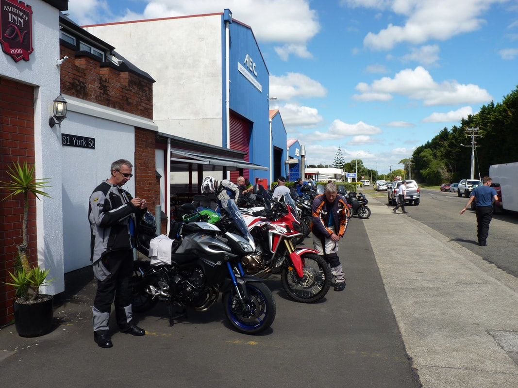
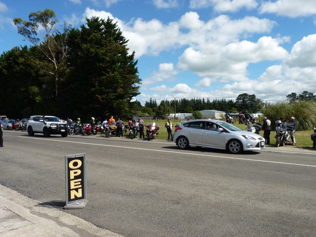
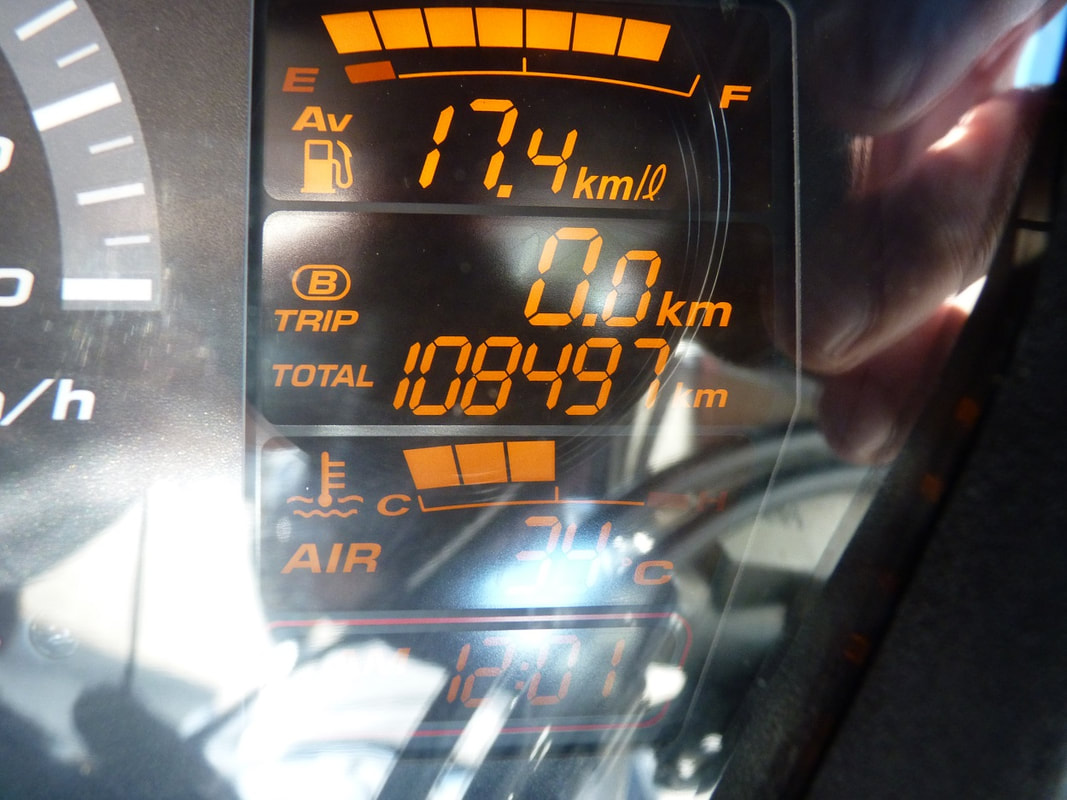
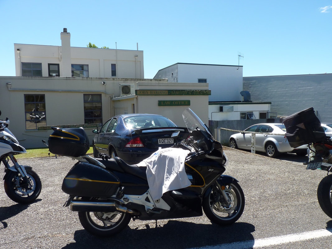
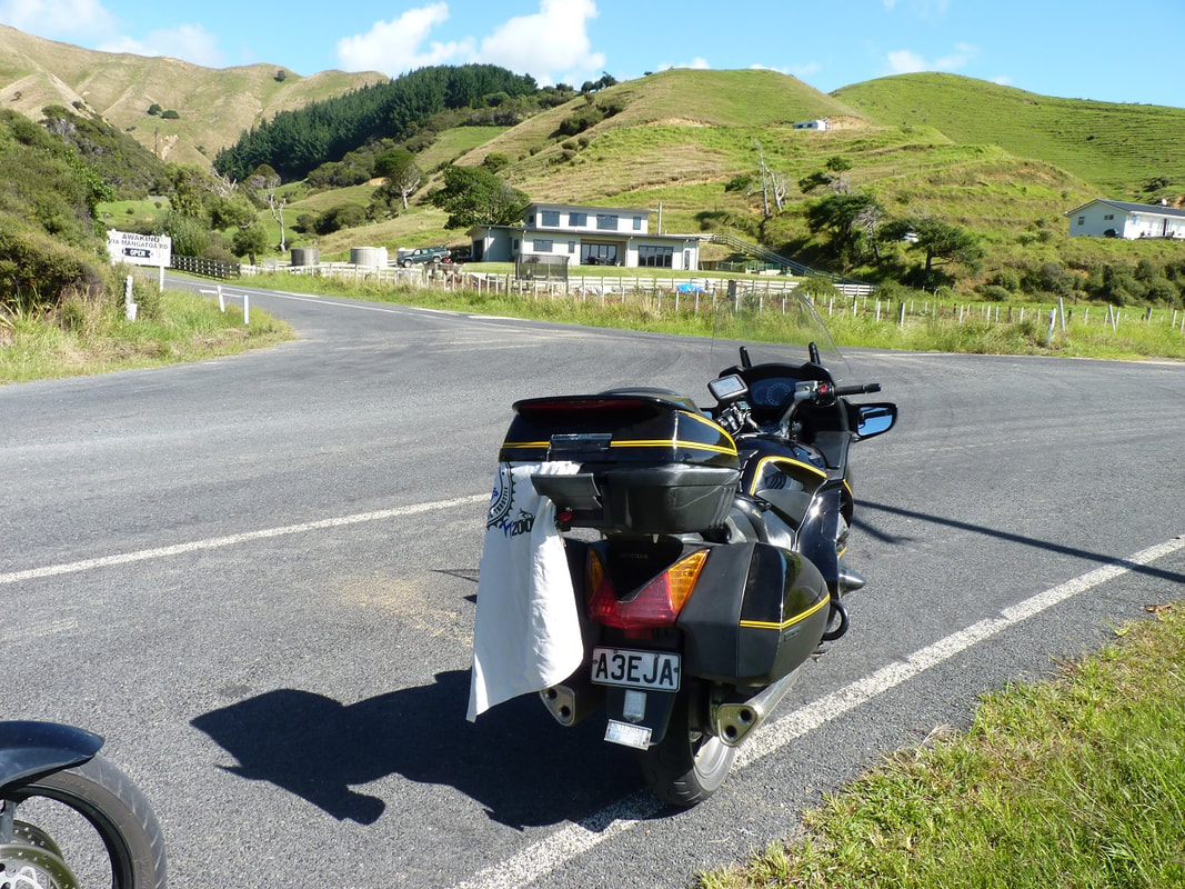
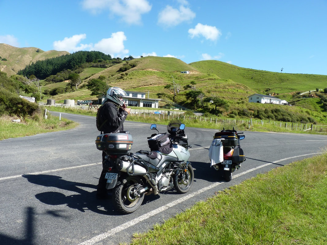
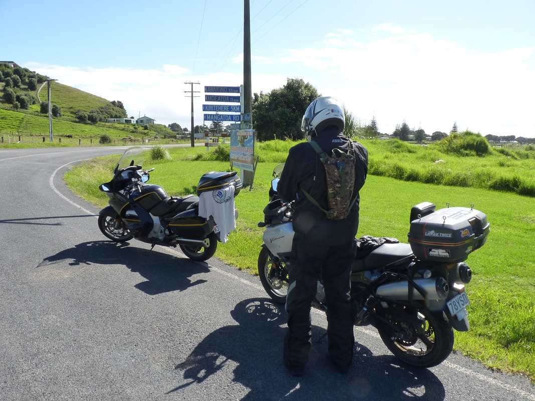
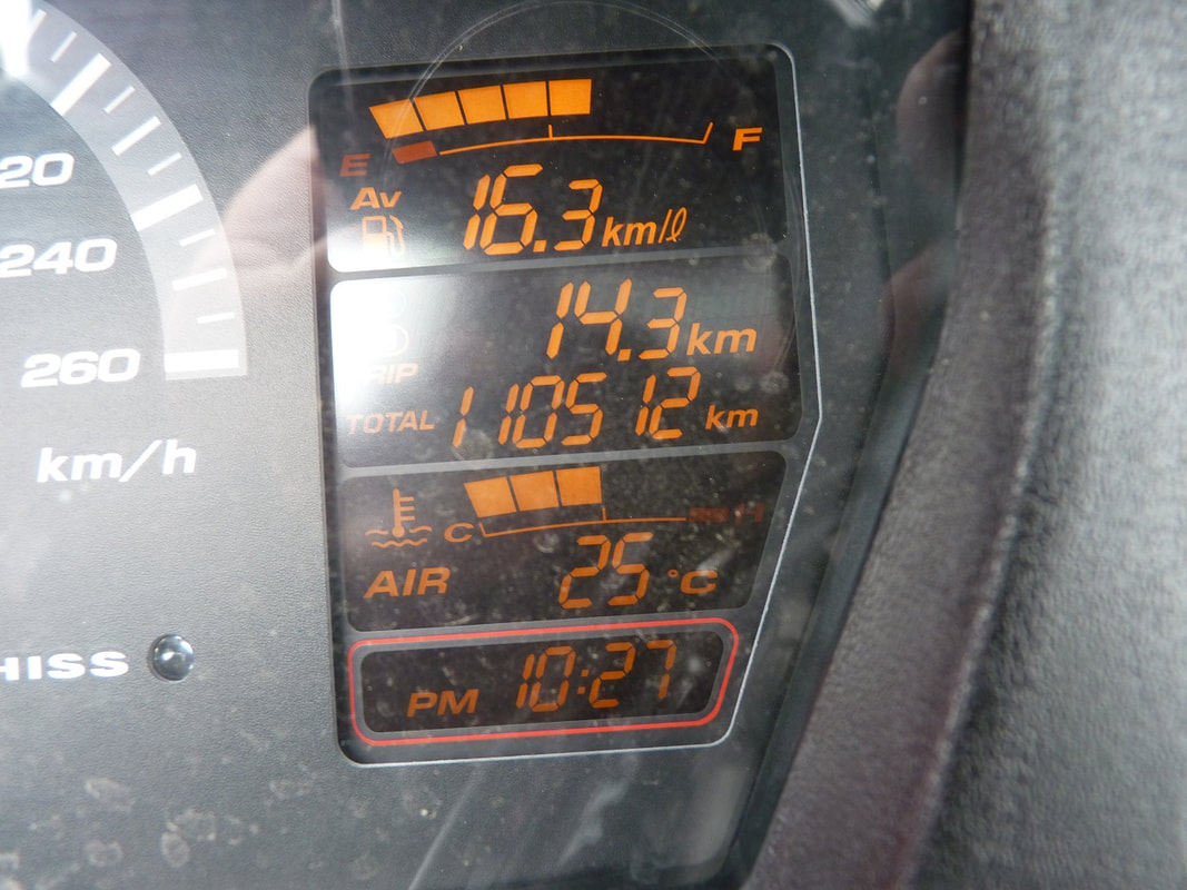
 The TT2000 was this weekend, which was a ride incepted in 2009 by Mike Hyde, who wrote the Twisting Throttle Books and hence TT. The 2000 is because it is 2000 Km in 48 hours …or at least, it is for most. The ride concept / details are usually released around July for the February ride and in the current format (it has morphed through a few variants over the years) riders are given a cluster of compulsory checkpoints which they can collect in any order, plus there are 4 ‘Mystery’ checkpoints (one is given a photo to work out what and where), then there are optional ‘Flyers’ in the general location of the checkpoints, plus ‘Adventure Flyers’ (ie gravel road access for those who like to lurk on the darkside!) I should mention that Mike died a few years ago and fortunately Wayne Poll and a few others have kept the ride going ….and I might add that the organization of this ride way exceeds what we have to do for the NZ Distance Riders rides. When I saw this year’s options I was quite interested because the ride was in the North Island (in the past it has had optional sections in the North, or in 2018 one could opt for a North or South total route). I should also mention that just getting the compulsory CP’s doesn’t accumulate enough points, or enough km to qualify for the ‘badge’. Anyway, it struck me that this ride could probably be done in 24 hrs: a) because it was in the North Island and I was sort of familiar with most of the roads and b) because I knew where three of the Mysteries were and they were on the route, so all I would need to do was run up a few extra km on an unmonitored quick road. From there I did nothing as I was a bit preoccupied with other things but the concept and a plan was lurking in the back of my mind, then after Christmas I had a good look, formulated a route, changed it, then invited one or two like-minded souls to join me. ….well I thought they were like-minded but all I got in response was, “You’re mad!!” So much for thinking people are friends! Although to be fair, the main reason the invites went out was because someone who has a bit of a say in what I do ‘demanded’ that I be accompanied! FFS, when I responded that I was and there were another 160 riders doing it, apparently that wasn’t good enough!! *Sigh* … It took some convincing, but in the end, I was granted leave! I should mention here that on past TT2000 rides I have done, I could put in up to 40 hours of prep work, fine tuning the route and CP options, identifying CP’s that could be dropped if we were slipping behind schedule and trying to allow for all sorts of contingencies. This year there was very little of that …..because I’m just a dickhead!!! The extent of provisioning and prep was: 1) to see if the organisers would allow my plan, (it certainly wasn’t encouraged, but you could sort of sense the sigh and the thoughts of “oh bloody hell, one of those” running though their minds, 2) get the bike serviced for it’s 132,000km check, 3) print a booklet of the CP’s, scale the route schedule to the requirements of a 24 hour tie frame and drop the route to the GPS …oh yes and liaise with Chris Wiltshire to work through some issues I was having with Spotwalla and this was important as it would mean I could apply for an IBA 2000 Km in 24 Hrs Saddlesore. During the ride I recalled an old saying that went, “Fail to Plan – Plan to Fail!” Yes well more on that as we go. Thursday night rolled up and the forecast was generally good, the bike was prepped and clean, a bag was packed (on the pretense that I could then stop if I needed to). I had a supply of water, nut bars and bobby-bananas, wets, which I wouldn’t need, and all the other crap that one carries when they get into this type of riding. 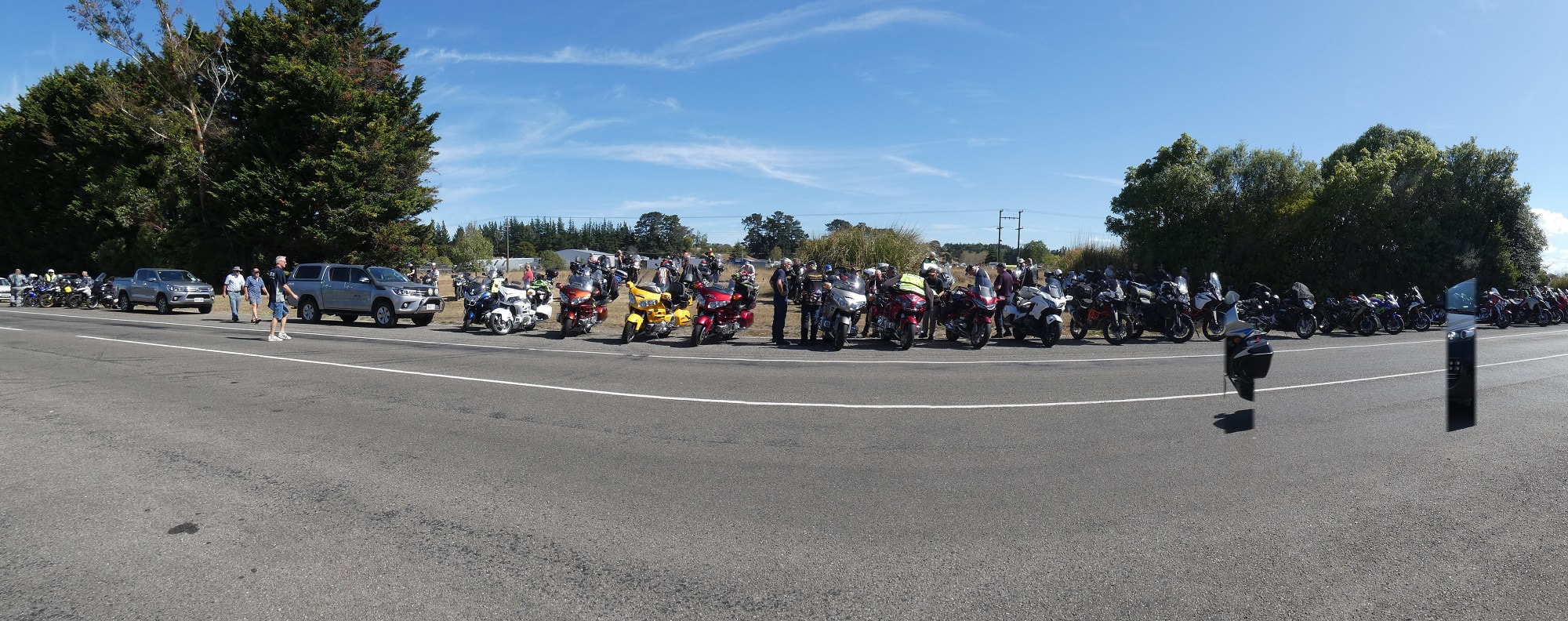 Friday morning and I was on the road by 0800, headed up to Ashhurst, filled at the Mobil there at 0945, then went to the start/finish at the pub to register. I then remembered to reset the odo’s on the bike and GPS, take a photo of the bike mileage, then loiter about meeting riders I knew etc until the briefing at 1145, then grabbed my T-Shirt (CP photos need to have the T-Shirt in them as this means they can only be recorded after the start), then I was one of the first riders away, which was a good thing as I was opting for an anti-clockwise route which meant my start would take me over the Saddle and it’s bad enough passing cars over there but nothing worse than trying to pass bikes …that aren’t passing cars. So I was off to a cracking start! 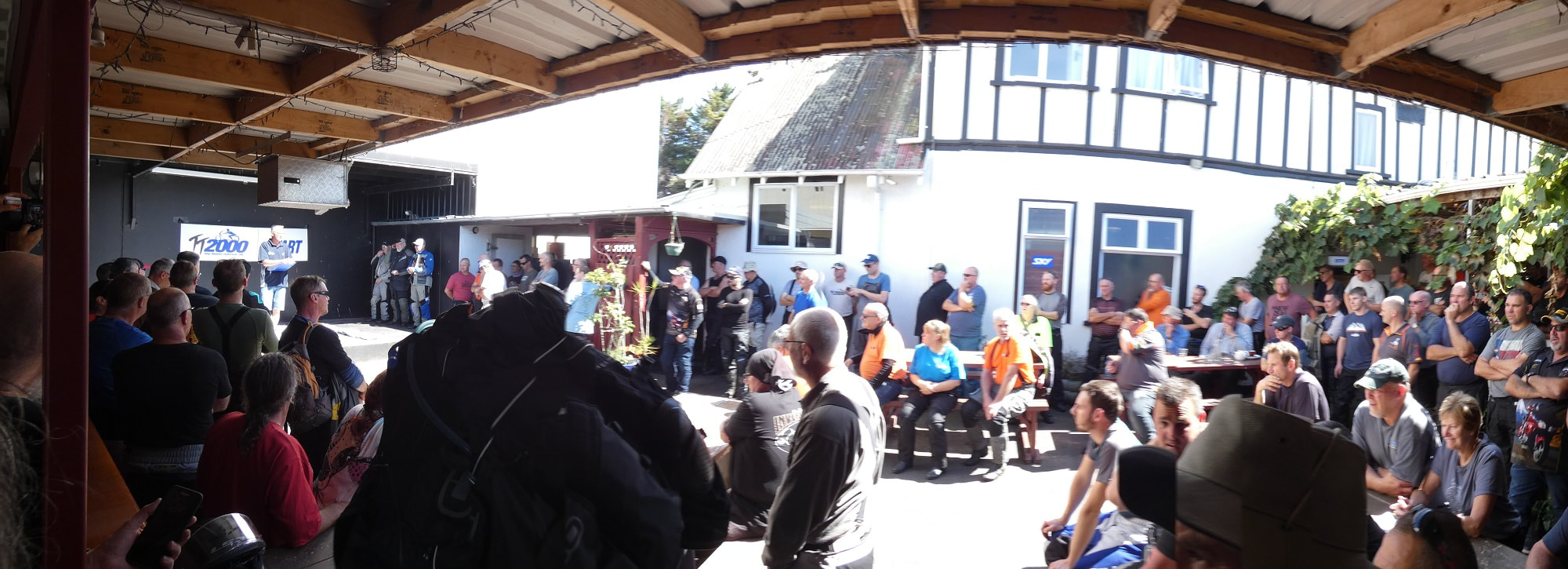 I guess I forgot to mention that this ride involved 20 photo stops and 5 fuel stops, with my plan allowing for a generous 2 minutes per photo and 10 minutes for fuel, which equates to 1½ hours of stopped time. Now I have managed to get photo stops down to 45 seconds and fuel down to 4 minutes, so there is potential to save up to 45 minutes in the stops, ….however, it is easier to take longer than the provisioned times, or need extra unplanned-for stops that chew time on the road,. Another thing I did for this ride was tape the ride schedule to the tank so I could easily identify the CP’s as well as check my distance, fuel and compare my progress to the schedule So I needed the cracking start. Anyway, I scooted over the Saddle (sometimes within the limit) bypassed Woodville, flicked off at Mangatainoka (the home of Tui Beer), skipped across to Kaitawa Rd …only to find it was closed (Roadworks) (FFS?). There are certain roads in this area that I know very well and quite a few that I’ve never, ever been on and Mangaramarama Rd was one of these, but I took a punt that it might link across to Hamua Rd, but alas, this is Tui country so that was a big “Yeah Right!, it was a dead-end and I just wasted 5Km! ….(double FFS!!!). There were bikes stopped at the closure when I got back and sprinted in to Pahiatua to head South to Hamua Rd and I found it odd that a couple of the Masterton boys were on SH2 (but they must have known about the closure, I passed them with several other bikes in tow and took Hamua-Rongomai Rd to get to the other end of Mangaone Rd, which would have me back on track to Alfredton, via Pa Valley Rd, then I was surprised to see the others continue straight ahead on Tawatai Rd! That’s Gravel! …but they were on adventure bikes ….bloody darksiders just saved themselves 6.5Km! Meanwhile I galloped through to Alfredton and on to the CP, pulling in from the North as the dirty dogs pulled in from the south ….must have been slow gravel?? Oh yes, and Pa Valley Rd had a section with a good sprinkling of dust and grit. I came onto it at pace, misread the dusty surface and experienced a massive slide on the front wheel as the whole bike started to drop to the right. I had corrected on the front as the back wheel started to slide, then it stopped sliding and turned into a high-side …but fortunately the correction to the front wheel had started to correct and it had just enough momentum to bring it back upright and back on track! Biker Hail Mary’s were uttered! I pulled my T-Shirt and camera out, stuck the T on the tank stepped back, the T blew off the tank, I picked it up, positioned it again, took the pic, then had to pull the phone to force a point on the Spotwalla track as it only samples every five minutes and this was an out-&-return point, then finally got back on the road …using all of my 2 minutes!! My plan originally had me collecting this pic, then going out the same way to SH2 to go to Dannevirke, then into Weber for the next CP. This was because I needed extra Km on the ride and knew that I could collect extra Km whilst making better average time (even within the limits), so whilst taking the diversion I had considered whether to now take Route 52 via Pongaroa instead and that is what I did. The other thing that happened at this time is that the GPS had fixated on some phantom, missed via point, so I had to stop the route and reset it, only to find that the Weber CP had fallen off the route!! Bugger Me! I added it and got on with the job …all on the fly. I caught three other riders through here considered that we were hammering along at a good pace, but shit it was hard work and I didn’t really need that with another 23 hours to ride. Initially I was riding the rut to avoid the abundance of loose grit, then as the temp got up to 29º, I found myself riding the hump to avoid the glistening ruts. I passed the other riders before Pongaroa then lost them after that, thinking they must have stopped there, but then I encountered them again when they caught me at a stop-go for Road Works! We scooted through to Weber to find the Renshaw boys already there, I fumbled around three times with the T this time, did the phone thing again, then was surprised to see all the other riders had opted to head back out to Dannevirke rather than opt for Route 52. Damn that would have been hard work to make good progress in this heat and I was operating to a strict time frame. I caught the other three, we passed the Renshaw boys and mate, then I lost the others as we approached Dannevirke and I took Tipapakuku Rd to bypass Dannevirke. From there I was extremely happy with my choice to come back to SH2 because I was clipping along at a little over the allowable limits, but it was very relaxed and easy riding. …and then I discovered that the Waipawa CP wasn’t on the GPS route either!! …so I added it. (Fortunately I had downloaded the whole GBD file including every CP, so these CP’s were coming up at the top of the list, being the closest to my current position, in the ‘favourites’). I pulled into the Waipawa CP to find Roger & Bee Allen taking a snack stop in the shade, so I took my pic (without issues) then had a short chat (using all of my allotted 2 minutes), then carried on. Next stop was the first Mystery CP, being allotted the nomenclature of Mystery #4. Obviously the producers of the route were ‘Clockwisers’ and I was going the wrong way. Interesting that I was asked before the start which way I was going, to which I replied, “Anti” and the response to that was, “That figures!” Now what the hell does that mean? Anyways, Christ Church appeared to be hosting a wedding or the likes at the time so that was almost convenient and I didn’t even cross the road to get close, just hopped off, placed the T, snapped the pic and lit out for Bay View. Once again (this is looking bad isn’t it) BP Bay View was scheduled as my first fuel stop (to get the 98 octane and AA fuel discount) while Mobil Bay View was the CP ….but it wasn’t coming up on the GPS!! No worries, I pretty much knew them off by heart…and I had the list on the tank …but it would get dark later and the list wouldn’t do me much good then, would it? So, bike fueled, my third or forth wee banana snacked, with a gooey nut bar this time (do you realise it’s almost impossible to buy a decent nut bar without chocolate on these days?), a natural break taken and probably well and truly past the 10 minute allocation, then it was 200 metres down the road for the CP pic, then it was on-on to the next Mystery, being the Lighthouse by the river in Wairoa. It’s always nice riding through there so I continued to make good time and arrived to see Topher & Goose enjoying a snack, they departed as I was doing my thing with the T and another banana, and then I was surprised to catch them on the road. I say surprised because Topher is not a rider I’d like to try to keep up with when he is ‘on a mission’. As it was, I was happy to slot in behind them as they were almost on the same pace as I had been, however, he was more relaxed with the passing and in the end I felt I needed to keep on track to stay ahead of the schedule, so I passed them. Well, I passed Goose and I’m sure at that point Topher lifted the pace ever so slightly?? …now I couldn’t attest to that in court, but to support my claim, a quick check in the mirrors indicated that Goose had dropped back a tad!? Of course, perhaps he just forgot to speed up again after letting me pass?! Anyway I lifted again, failing to keep those beautiful lines that topher does, …but managing to make good progress in my own poor form! As I entered Gisborne I happened to notice that I had just ridden past the turnoff to the Te Araroa (East Cape) road and thought, “Hmmm, I’m sure I should have taken that road?” and a quick check revealed that sure enough, the GPS was taking me into town, for no particular reason, then onto Opotiki??? Another sigh sighed, a quick addition to the route and I had to ride through the Main St of Gisborne to get to Wainu Beach! It wouldn’t have been much, but more time lost! This time I had to have a quick check of the booklet to ensure I was photographing the right thing, then Topher & Goose turned up as I was ready to leave. At this point I was about 550Km into the ride and about an hour ahead of schedule as it was closer to 1730 than the calculated 1830, and I was about to embark on the Waioeka Gorge and the temp was dropping from the 32º peak experienced earlier. Now heading for Opotiki, I wasn’t passing much traffic, but there was a bit coming the other way and it wasn’t until he was right on me that I noticed a big white ute had some natty squares painted on it. Whew, he either didn’t have a device, or it wasn’t on, (probably didn’t have), then another 5 or 10Km down the road I spotted a car with similar markings. Now I did have the sun in my eyes at this point, but I’m sure he was giving me the evil-eye and possibly a finger shake, but he didn’t turn and pursue so I was obviously operating within the allowable limits aye? The ride through there was quite good (thankfully with a dry road as lots of potential slick spots) and I had soon fueled at Caltex Opotiki, then taken the CP pic as I left town. On this occasion I had to check the booklet again as I pulled up beside a sign, then discovered I needed to take the ‘50Km Opotiki’ sign, but I was able to do that from where I had stopped. Next stop Maketu and my plan had taken me via Taneatua as this adds 5Km to the distance for about 2 minutes extra on the time. Now prior to the ride, I had had discussion with other riders about the merits of the Taupo Turangi road (which has major roadworks) versus the Western Lake road and at this point I realised that Wai-o-Tapu (Sth of Rotorua) isn’t that far from Awakeri, and that perhaps this would be a better option as I could then drop straight to Turangi from Tirau. Problem at this point is how that would affect my fuel plan and timings and since I’d known about the road conditions prior to the event …I’d failed to plan for contingencies, so stuck to the plan I had! The 116km trip from Opotiki to Maketu saw it transition from dusk to dark and with just a sliver of moon, it was to be a very dark night. (this section was scheduled as approx 2100 to 2200, but I was still about an hour ahead). The Maketu CP was new territory for me and it had dunnys, so was rather convenient. I did my thing, put on a skivvy as I was starting to feel cold, in the ever so balmy 17º, and got back on the road to find the GPS was trying to get me to decide whether or not to take the toll road, so I selected yes to take it, but turned out I had selected yes to not take it. I wasn’t too fussed either way, but it probably would have been better to get straight on the Expressway. Tauranga didn’t pose any problems and then I had the 60’ish Km of double-yellows to Waihi and a bit more traffic than I was expecting, but that was probably partly due to me being ahead of schedule. I enjoyed a good fang up to the next CP at Whangamata, then down 25A to the Mystery #2, the Bugger Café Tractor (I thought it was Bugger-It Café) on SH25 at Pipiroa. From there it was on to my next fuel stop at BP Bombay and that was really odd because I was thinking it was a manned 24Hr jobby? Well it is, but via a window slot for fuel only, which was a bloody nuisance and at this point I did put the wet jacket on as the temp had dipped further. The next CP was just down the road at Pukekohe and once again, I got to the CP ok, but then had issues getting out. I was supposed to do a loop, coming out on a different road, but the turn didn’t come up and I found myself heading off to NeverNever Land. I thought I should have been heading towards SH1, But I had no idea, so I turned around and headed back into Pukekohe, then I missed the turn to take me back to Bombay so went around the block, chewed up a bit more of my bonus time and eventually got back to the motorway and onto my next CP at Whatawhata. I thought the Huntly Bypass had opened a few weeks ago but not so, and I was stuck in traffic due to lots of lane closures, so when I got through Huntly, I stayed on the (familiar) road to Ngaruawahia, through to te Kowhai and on to SH39. I was soon at the Whatawhata Rugby Club, then off to Tirau …the next right royal pain in my arse! Nice easy riding through Hamilton, onto SH1, around Cambridge, through Karapiro and got to Tirau …only to find the Main Rd (ie SH1) was closed!! FFS you Double-Die Kiwi Bastards!! I didn’t have time for this so I slipped onto SH27 and headed East, with half an idea of where I was going?! What really pisses me off though is now that I have had time to look, I’m not totally sure but I did about 10Km up to Okaroire and back, whereas now I see that there was a street 200mtrs up the road that would have taken me across to the CP at the Fire Station! I don’t know if that was just another problem with the GPS, or perhaps that it hadn’t re-calculated the route after turning off and I was passed the turn, however, it should still have suggested a back track?! …or perhaps it was and just got lost I the blur of my mind? I now needed to get to SH5 to get across to Rotorua, then down to Wai-o-tapu. Before the ride I had had a discussion with Topher, about the Taupo-Turangi Rd and made the decision to take the Western Lake, as that would buffer up my total Km mid-ride, rather than at the end, but it occurred to me whilst on the road that this could upset my fuel programme as I wasn’t totally sure how many Km I was adding (even though I was on a very conservative programme). I made a decision to pause by the BP on Fairy Springs Rd, where I was on about half a tank and thought, “I should have heaps” then carried on, but after grabbing the CP pic at Wai-o-tapu and as I approached Wairakei, I noted I was down to three bars, but hadn’t been monitoring the level close enough to know how far into the third bar I was, so I gave in and headed straight to Turangi. The road wasn’t bad at all, with a a few sections of gravel, but there were two sets of stop-go lights and the first set was several minutes. Not what you want when you’re on a mission. Another issue that manifested at the first stop was for me to notice fumes rising out of the front of the bike and a bit of an odour that I didn’t recognise …but I wasn’t in a position to check it out so I continued, took the CP pic at the rest area as I entered Turangi, then headed to the Z for fuel. This is another 24 hr fuel stop that in the past has been open all hours, but now isn’t even manned! Next stop, Awakino, so I was off over SH41 to Taumarunui, SH4 to Eight Mile Junction, then down SH3 to the Waitomo Garage at Awakino. I had now been up for over 20 hrs, this leg was taking me between 1400 and 1600km into a ‘spirited’ ride (not to mention the 150Km to get to the start) and I was starting to feel the affects of fatigue. Not what one wants so as I came into Pio Pio, I made the sensible decision to have an extended unscheduled stop. I pulled into the dunnys which had a nice disabled/mothers restroom in the middle. I was therefore able to take the helmet and jacket off in order to put a 2nd skivvy on, as the temp had come down to 11º. It was also raining, though not very bad, which the forecasters had predicted, but I thought it was just local so I left the wet pants off and just changed to the winter gloves. I took the time to have a daily constitutional, then took a multi-vitamin tablet with water and a nut bar, jumped around a bit, which the trucky sitting across the road must have thought a bit strange and eventually felt pretty refreshed and continued on my way, feeling much better and prepared to attack the Awakino Gorge. Yes, well, I had been advised about roadworks at the start of the gorge, but once again there were two lots of lights and more wasted time. I did end up behind a big truck but took an assertive approach and he didn’t bother me for long and I soon had the Awakino pic in the camera. It was now lightening up and next stop was Okato! I was surprised to find that Mt Messenger has finally been resealed and has a good surface, I made my way through New Plymouth and in no time all had the Okato pic, but where I had expected to be coming out of the rain now, it was just getting worse. This was a real problem for me as I was relying on opening up the taps as I made my way around the Surf Highway, but now I had to take real care …you could say I was torn?! In the end I decided that I was too close to the goal and I needed to throw caution to the wind. This did too things. It meant I was able to stay on track and preserve my time buffer, but probably more importantly, it required heightened focus that really did get rid of any more symptoms of the fatigue that was starting to creep back. I took huge care to ride the hump to maintain the best traction possible and let the speed roll off if I thought it needed to and ….well I guess I’m still here to tell the tale, so all was good …and I made it to Manaia to get Mystery #1. When I got to Hawera for my last fuel stop, I used the pay-at-pump option and couldn’t get a receipt, but figured I didn’t really need it anyway. I also finally put on the wet pants and changed back to the Summer gloves with Rain-Offs then continued the battle with the conditions and a bit more traffic to the last CP at Kowhai Park in Whanganui. That done I was still only on 1900Km so I needed to burn some Km and started to think about the best option as I headed for Ashhurst. In actual fact, considering I had added a few Km in a couple of spots, I was actually close to target, so I must have been cutting a few corners, although Route 52 via Pongaroa would have slashed a few K off the total. In the end I opted to take Whanganui rd into Marton (rather than Makirikiri Rd to bypass it), then headed up to SH1 North of Marton before heading down to take the halcombe – Feilding – Colyton roads to Ashhurst. When I got to Ashhurst the odo was reading 1990Km and the GPS was showing 1984Km, so I decided to head up the Pohangina Valley for 10Km to give me enough buffer to cover both readings, plus I’d forgotten to send a forced point on the out-&-return to Wainui Beach, so I went about 1Km past Pohangina Valley East Rd and stopped to plant a message/point on the phone …only to find the phone was dead! FFS! It was pissing down so I just hopped on the bike and headed back to the pub. I got back to the pub at 1122, took the gloves off and grabbed a towel to dry the dash and the GPS, pulled the camera and photographed the odo and GPS Tripmeter, then went inside for some relief, after which I realised I needed to contact Ann to let her know all was well (in case she had been trying to contact me) and Wayne to advise I had finished and hadn’t just gone Awol. The phone had been plugged into the bike power, in the topbox, for the whole ride and as it transpired, it had decided it didn’t want to be charged any more and (fortunately) it was dead flat rather than cooked (it had felt a bit warm). I then grabbed a power pack and went back into the pub to make the text and call. I was going to have a feed, but as I was dripping I decided to just get back on the bike and putter home! I was back home by 1330, having done 2306Km all up and feeling a little shattered! I figured I was OK for the TT, but had lost my track for the Iron Butt, so I downloaded the photos and dropped them in the TT dropbox, then went to download my GPS tracklog ….only to find there wasn’t one!! That pissed me off more than anything as I usually refer to that for the blog and check stuff and hence a blog with now ride stats at all. …and that really finished the thoughts of qualifying for the Iron Butt saddlesore. This would have to be the worst ride I’ve ever been on for issues, especially with the GPS combined with the most inconvenient road closures, but along with the lack of options due to lack of planning was just dumb! I nodded off on the couch a few times before finally going to bed and now my wife is telling me I should have listened, not gone on the ride alone and although I can say, “I knocked the bastard off!” there’s certainly some merit in enjoying doing it over two days, at a comfortable pace, with stops and meals, and drinks, and telling lies over a beer with like-minded mates at the end, but hey, although maybe I shouldn’t have got out of bed for this one, “I did knock the Bastard off!” That’s three 2,000+Km rides I’ve done now and takes my 1600km ride tally to 14. I’m still anti, an arsehole and certifiable!
8 Comments
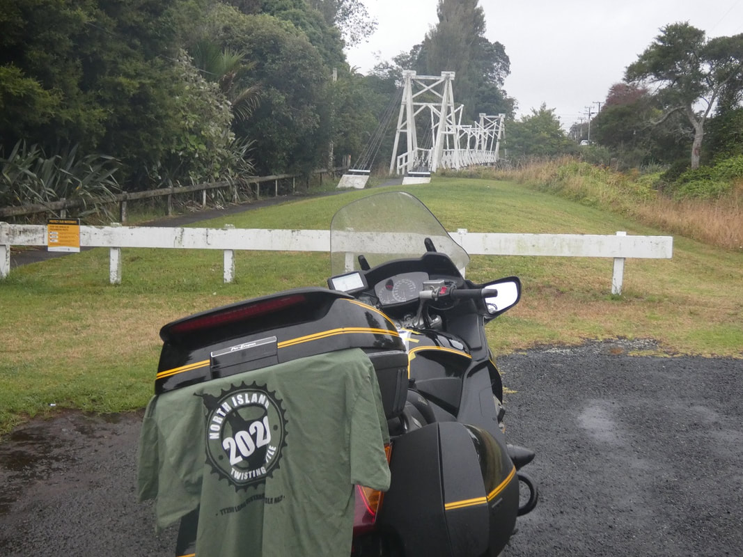
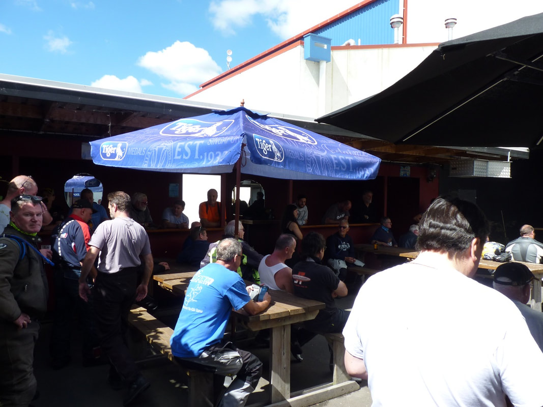
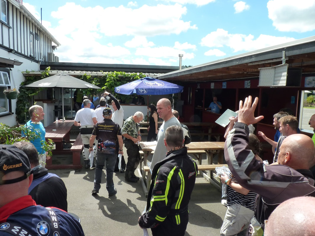
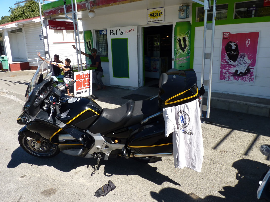
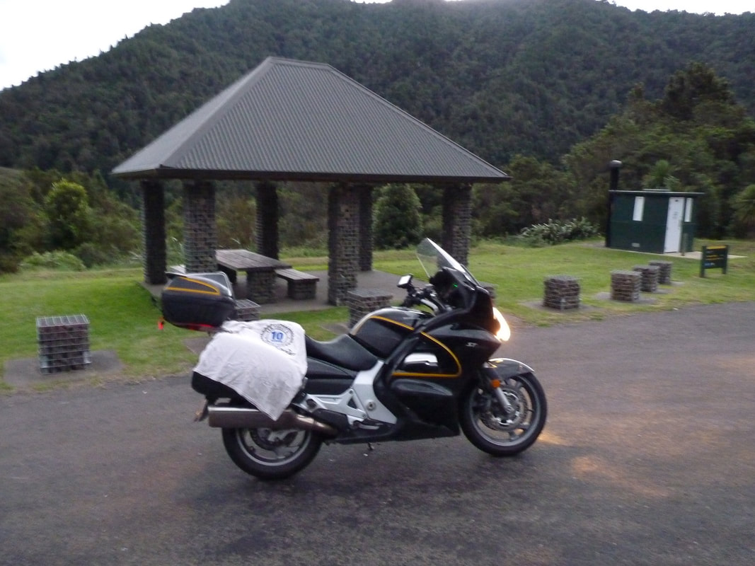
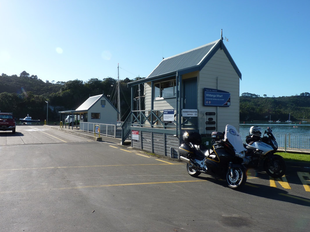
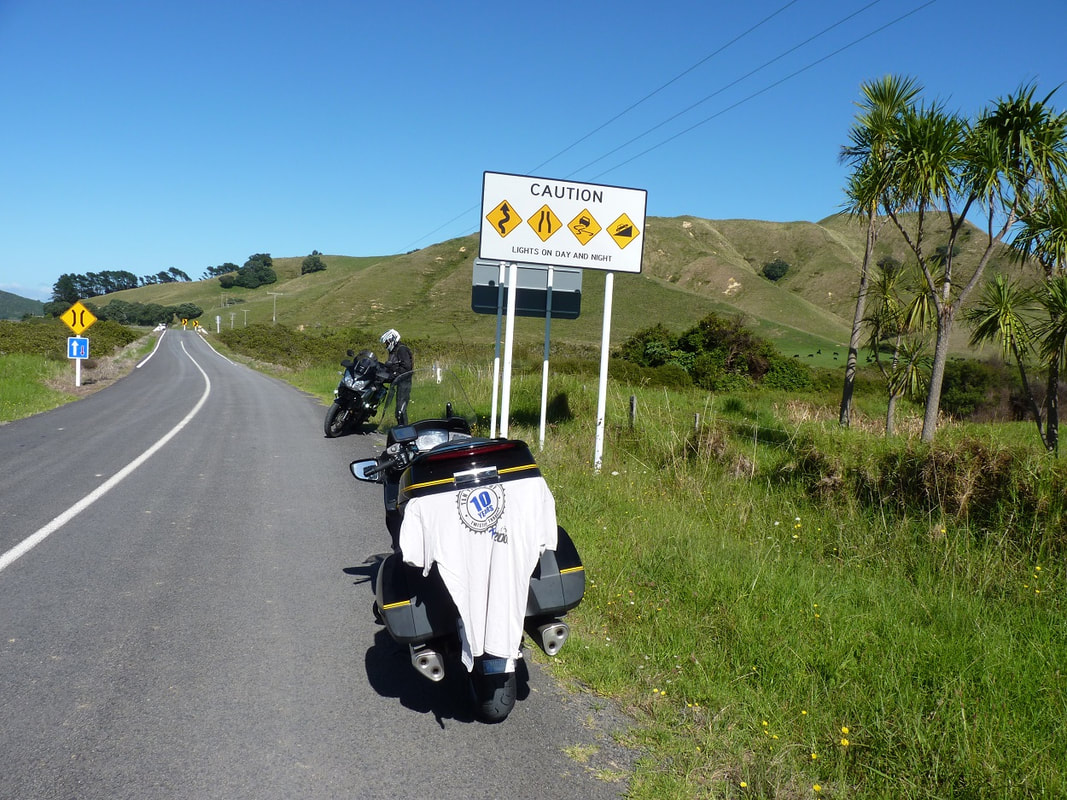
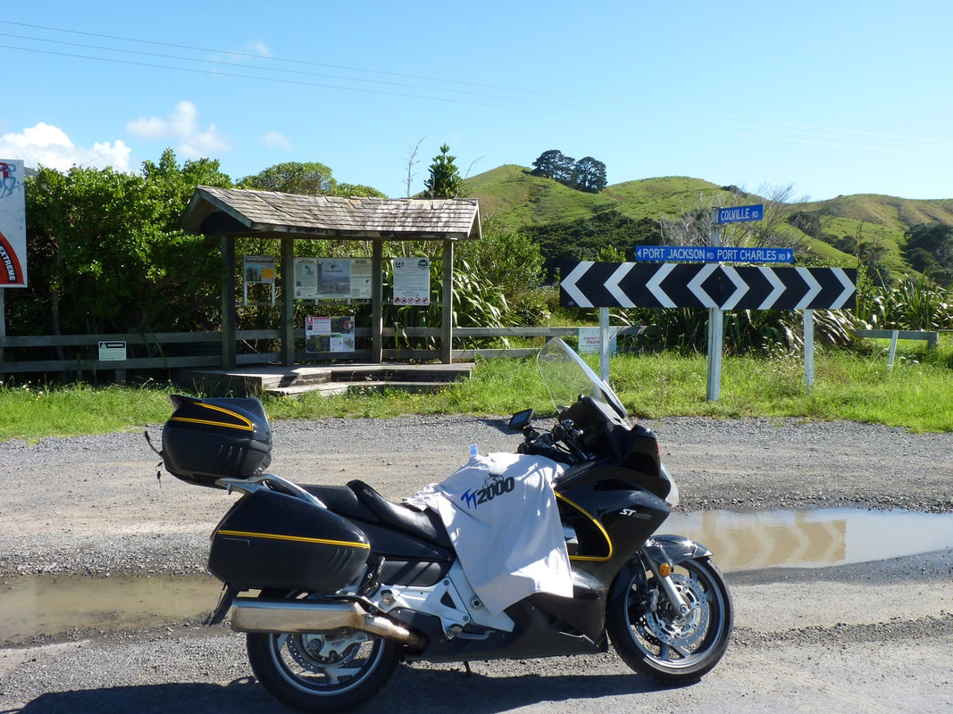
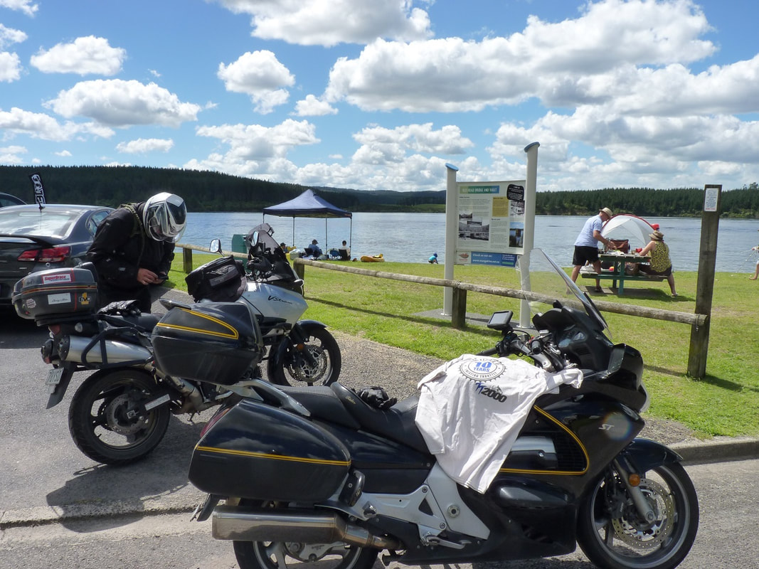
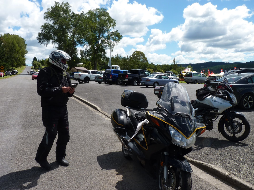
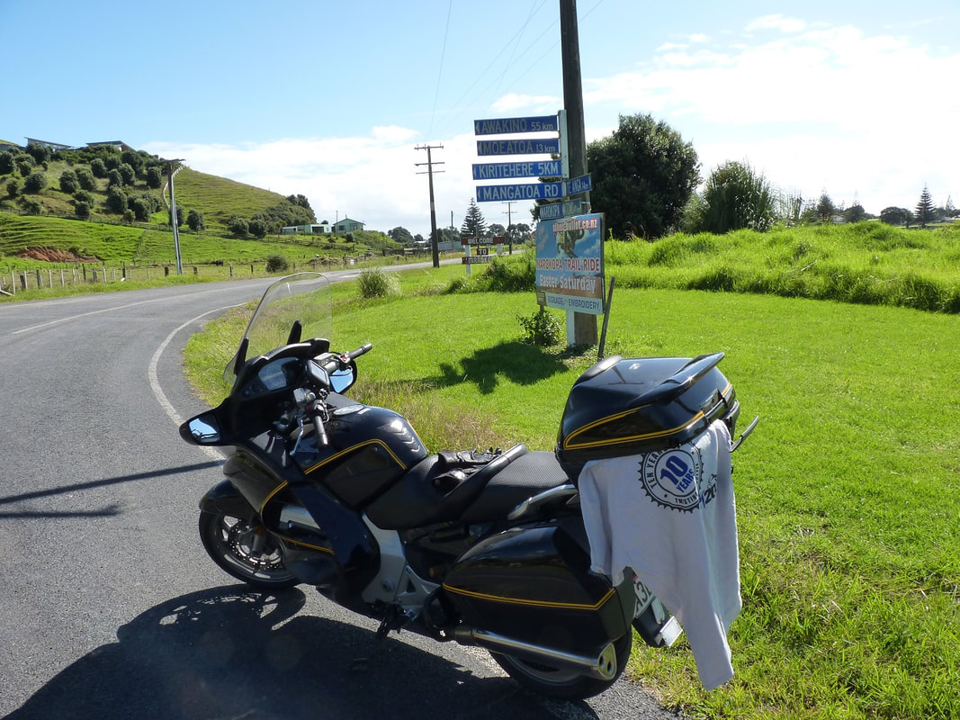
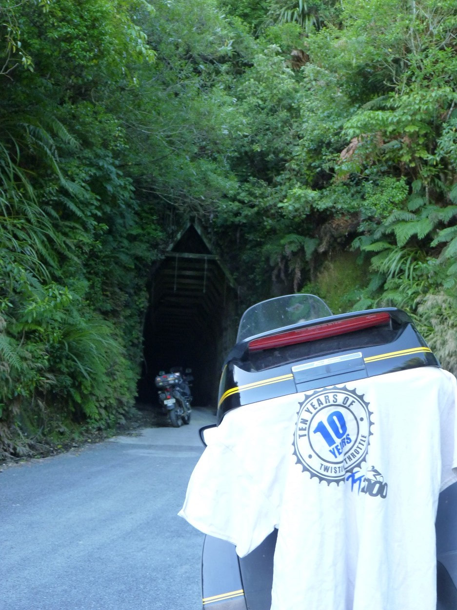
Yeah …..well that was good!! I had entered and gone through the motions of plotting a route, (that looked quite doable in one hit), then it was looking a bit marginal that I would be riding, however when my long-standing riding buddy, Steve, confirmed he had entered …. that was that …. I couldn’t let Steve down could I! That resulted in some correspondence with Geoff, ( http://geoffjames.blogspot.co.nz/ ) to check out road options, potential fuel and the prospect of riding the Coromandel Peninsular, this turned out to be invaluable), then tweeking the route to split it over three days, working out fuel stops for Steve’s 300-350Km range, where to stop for the nights and book accommodation, then make sure I was up to date at work. The bike was serviced between Christmas and New Year with a new rear fitted, but when I did my first fuel stop on the way to Ashhurst, I noted that the last fill was in December, so the service might just as well have been earlier in the week. I cleaned the bike on the weekend, ensured the usual bits and bobs were packed and hit the road at 0740 on Friday morning to meet up at Steve’s, where we had a coffee, chatted for a bit and commenced our adventure at 0929. It was an uneventful ride with me having to fill at GAS Eketahuna, while Steve filled at Caltex Woodville, because that meant he was within range of the first fuelstop on route and we arrived at the Ashhurst Pub at 1142, with not much spare time before the briefing and midday start. I thought we had fluffed around a bit, collecting our T-Shirts (which are required to be on the bike for the checkpoint photos), then preparing to leave, but the Tracklog shows we departed at 1202, so perhaps we were briefed early ….or maybe I was so hyped up that time was dragging ….or perhaps it’s an age thing and I’m losing it! Anyway, we started the weekend with a scoot over the Saddle and via Dannevirke, where we bypassed the CBD and must have passed several riders, then completed 98.8Km up to the first CP at Waipuk’, which was the back of the Angkor Wat Café (since it was deemed unsafe for us to be parking and snapping on the main street). We managed an average of 89kph then only spent a minute taking our pix, got back on the job and Steve having advised that he was having issues with his jacket zip, (which wasn’t staying zipped), so on the next leg, which took us through Napier on the Expressway, we paused at the Honda shop in Bayview. Fortunately they had one jacket in his size. It took Steve 11 minutes to walk in the shop, pick his new jacket, arrange to have his old one and the thermal liner from the new one couriered home, pay for it, transfer his wallet and bits from one to the other, put it on along with his helmet and gloves and start moving again! ….and that’s what I like about distance riding with Steve, he values minimising stops! The next section took us through to Wairoa, then out to Frasertown and this would rate as one of the North Island’s premier motorcycling roads and our first peach for the weekend. We managed to average 95kph for the 114Km and we loved every minute and every Km of it, took two minutes on the photo this time, scooted back to Wairoa Mobil for fuel and took 14 minutes to also enjoy a snack and chat to a few other riders as well. The next CP was the jetty at Tologa Bay and this meant another 151Km of sweet riding as the road through to Gisborne is just more of the Napier-Wairoa road and the 50Km each way to Tologa is a really nice stretch of rolling sweepers with a good surface ….so more enjoyment was enjoyed and at 1802 we were pulling into a BP back in Gisborne for the 2nd fill, 640Km done. A casual 10 minute fuelstop, snack and swig this time, then we had to embark on the Waioeka Gorge. *Sigh* ….we are certainly endowed with splendid rides in this country and thus our adventure continued on more peachy-keen curvy riding, however, when we arrived at Matawai, it was drizzling and getting worse, so we had to pause to don our wets before the short skip out to the next CP at Motu. That done, we were back on the Waioeka Gorge, but a now rather wet and slippery road, so the spirited pace we had been enjoying up until Matawai, was now more a tame and sedate limp. We had one more CP for the day and that was the Tauranga Bridge, but as well as the rain and wet roads, more problems stacked up by way of my Sena intercom batteries going flat! This in itself wasn’t a problem, but because the Sena had gone offline, my Garmin 595 GPS had a big warning banner covering 95% of the screen …..telling me what I already knew! That shouldn’t have been an issue either but I couldn’t get rid of it and therefore see when we would be approaching the CP, so I waved Steve though (thinking that he had the route in his 660 and it wouldn’t be a problem!!!) Yeah right! We had passed a couple of trucks, then the rain ceased and we were back on dry roads, then I spotted a sign alerting of our approach to the CP, so I put on my indicator, realised Steve wasn’t stopping, started tooting my horn and pulled over as I watched Steve disappear! Feck! It wasn’t the first time this sort of thing has happened but I figured he would realise I wasn’t there in the next Km or so, then turn around, so I took my photo, plugged a power pack onto the Sena then tried to ring Steve …..hmmm, no mobile coverage! ….bloody typical! Oh well, I cleaned up my glasses and visor, changed to dry gloves and generally farted around getting my shit sorted until Steve finally did arrive. I was off the road in a carpark, so I had left the engine running and lights on to alert Steve when he did return ….and 15 minutes later we were pulling out to head for our overnight stop. We arrived in Whakatane at 2113 and looked for a Chinese Takeaway or the likes, but alas, all that seemed to be open was the fast food outlets, but then we spotted a Subway, …but although the lights were on and staff were there it was locked, so we resorted to Pizza Hutt, ate on site and finally arrived at the motel at 2158, scrubbed and slipped into a coma!! Day one finished, 730Km done. Day 2 commenced at 0500, we cleaned up, packed, I tried a piece of leftover pizza but that wasn’t great, when checking the bikes discovered it had pissed down during the night, then we departed at 0551 in cool dark conditions. The first leg was a sprint up the coast to Bethlehem for the first fuel stop 93 Km along at an average of 97kph and we even found ourselves riding within the allowable limits (along the Expressway). We lingered at the stop for 8 minutes before embarking on that horrid 54Km stretch that is littered with double-yellows from Tauranga to Waihi …but then things changed again and we had to endure riding the Coromandel. *Sigh* …..life can be so rough sometimes …..with so many twists and turns …I guess you could say we were in biker-heaven! We had arrived in Waihi at 0737 and it took us until 0853 to complete the next 105Km to the first CP for the day at Whitianga, but we were feeling a bit generous with our time as we were ahead of our schedule so before stopping for a photo, we treated ourselves to some goodies at a bakery, although I just settled for a breakfast-like bacon and egg sandwich before going around the corner to get the photo. After 20 minutes all up, we continued up the coast to Kuaotunu, across to Coromandel and up to Colville and all was good until about 10-15Km North of Coromandel, when my GPS shit itself and decided I needed to do a U-turn. Fortunately we knew where we were going so after a bit of a fiddle on the fly, I just selected the CP from the favourites. We arrived at Colville at 1018, spent a couple of minutes farting around then headed back to Coromandel with thoughts that we might need to shift the programmed Thames fuel stop to Coromandel because we were both down on our usual economy for some reason. This wasn’t a problem though because we could still make the next fuel stop in Te Kuiti from either place, but we would assess the situation once we got close to Coromandel. We did fuel in Coromandel, then had a very sedate ride down to Thames due to the roadworks and traffic. We had been exceptionally lucky with traffic to that point because most seemed to be going to the other way and we only had to pass a few cars. Through this section there still wasn’t that much traffic in our direction but it was difficult to get past due to oncoming traffic, or cones etc…but it was only 50Km. Once we were across the Kopu Bridge we got back in the groove and had a quick scoot down through Matamata, out to SH1 at Tirau and off again at Putaruru. The plan was to go over the Arapuni Dam to Waipapa Rd and take that down to the next CP at Mangakino, however, that is not what transpired! Once we were over the dam, I noticed that the GPS wanted me to turn right onto Mangere Rd rather than Waipapa Rd and I didn’t have a great feel about this but Steve and I both have the faintest of shadows of Mike Hyde in us, so since we hadn’t tried this road, we took it anyway. Well! It turned out to be a narrow, unmarked lane and at one stage we had to avoid a bloody great tractor barrelling along the other way …and that wasn’t the worst of it. It turns out that this option was about 1Km longer than going straight to Waipapa Rd, ie. It took us 22Km before we joined Waipapa Rd, but the last 6 Km was bloody gravel!! ….but that’s not the worst of it either! …this gravel road wasn’t any wider than a driveway! ….what the hell was I going to do on the ST if someone came at us?? Well, we would have taken twice, or maybe even three times longer on Mangere and Huirimu Rds, but now we’ve been there and done that ….and most unlikely that I’ll ever do it again …but then it’s most unlikely that I’ll ever go to Motu or Kiwi Rd (yet to get to that part of the story) again!! Now we were finally on Waipapa Rd we got to enjoy the curvy lane through the bush beside Waipapa Dam and were soon stopping at the bustling metropolis that met us on the shores of the Mangakino Dam. We’re still not sure if it was speed boats or skiing as they were on a break while we were there, but the place was packed. The next leg was across SH30 to Te Kuiti ,then out to the coast at Marokopa, via Waitomo. I haven’t been on 30 for some years and it’s quite a nice amble through rolling country. We then fuelled and stopped for a 30minute late lunch at BP Te Kuiti before attacking the last 339Km for the day. The road out to the coast past Waitomo is another of the North Island’s dream biking roads, but on this occasion, some care was required because the temp was up and what would be a slippery road in the wet was now a potentially oozy road on a nice summery day. Damn shame that so much care had to be taken picking one’s lines, but a nice ride all the same, then after the CP at Marokopa, the 55Km road down to Awakino starts as a nice road, has about 10Km of nasty, corrugated gravelses along the way, then finishes with one of the best signs a bike rider could wish to see, a yellow diamond shaped sign with a squiggly black line down the centre of it and arrow at the top, and the best part ….wait for it, ….below that is a little rectangular yellow sign with black line around the perimeter and in the centre it says, “Next 27 Km”!!! Sweeeeeet!! And this road really is sweet. If one wasn’t buzzing with excitement, the motion would rock you to sleep! (Long Jahn says – Highly Recommended) From here we continued down SH3, over Mt Messenger to Uruti, where we had to take Uruti Rd out to a tunnel labelled on the CP data sheet as “Kiwi Rd”. I hadn’t taken much notice of this prior to the ride because I just didn’t have time, but when we got to the tunnel, we decided to go through it and take a pic from the other side, but at that point the GPS was telling me to turn right on Kaka Rd and keep going, so I pulled out my trusty NZ Nth Is Road Atlas and thought, this isn’t really Kiwi Rd, but it looks like there’s another tunnel up the road and that might be on Kiwi Rd, so we continued for a bit to check it out ….but we were soon on a dirt track so returned to the tunnel. It was really interesting to ride through the tunnel because it was a dirt track and the sides were carved into the clay and you could still see the scouring from the digger bucket. The bloody thing was effectively just a hole scraped through the clay. More pics taken at the front end and it was On-On for home. At this point we checked the schedule and even with all our stops and farting around, we were still operating on what had been scheduled as our optimum ‘fast’ time, which had us arriving in Hawera at 1900, so we decided to add a scoot around the mountain on the Surf Highway and that would chop 50 Km off Sunday’s ride. That meant Steve would need some fuel in New Plymouth and were now on the home run. The last hundred Km for the day was done in slightly less than an hour and we finally arrived at a restaurant at 1946, enjoyed a leisurely meal and drink, got to the motel around 2100, scrubbed, sat on the bed to watch a little TV, but nodded of and was well and truly in a full-blown coma by 2200. Day 2 done and dusted, 1,013Km for the day & 1,743Km for the trip. I awoke about 0415, then fell in and out of consciousness but we had earned a sleep-in for Day 3 and didn’t get up until after 0630 and got on the road at 0736, however, in those waking moments route options for the day kept swirling around in my little brain. In planning this ride I had strayed from my normal anal, pedantic, OCD tendancies and just connected the dots, accepted the results and did a little tidying up. Normally I would rename and load all the all the checkpoints, then load each day’s route, and now I was regretting my slack attitude. When the GPS started playing up on the way to Collville, the CP’s were all in the Favourites, but who was to know whether we were supposed to be heading for Chapter 11 or Chapter 4. Well, of course I would normally but not on this occasion. The other thing was that separate daily routes have several benefits, especially when it comes to tweeking the route if needs be. Anyway, I had loaded the route with a ride up the Para’s on Sunday and after adding the Surf Highway on Saturday, now I had difficulty working out exactly how many Km we needed for Sunday because I couldn’t remember how many Km we were short if we went direct to the Vinegar Hill CP, then straight to the finish. The other problem was that I hadn’t reset the GPS trip meters at the start, so I didn’t know exactly how many Km we had done. I had been mulling over all this and decided we should go around Santoft, out to Parewanui Beach, then up to the Vinegar Hill CP, out to Cheltenham, up to Rangiwahia then check how many more Km we needed after that and once we got up, I manually loaded that into the unit, then it dawned on me to enter the direct route in and at that point, realised we were only about 30Km short!! Bloody hell, that was easy so we decided to see how we were at the CP and just add what we needed. We had finished Saturday at a relatively spirited pace and started Sunday on the edge of the allowable limits (or thereabouts) and it was pretty straightforward. We zipped into Whanganui to the BP on the bypass for me to have my first proper fill for the weekend, then carried on through Turakina and took Makirikiri Rd across to SH1. Once we had turned onto Makirikiri, I note that the GPS wanted us to turn right onto SH1 and I though ….”WTF!!” So I zoomed out and noticed that it wanted to take us via Halcombe and up to the CP from the bottom! So Cooool! I had noticed the day before that some roads in the unit had a green tinge to them and wondered if the unit had stolen old route data from the PC and this sort of confirmed it because it was even taking our usual bypasses. The old 660 never ever did that. I advised Steve of the change and was pleased to be avoiding SH1….and our canter became more of a gallop to the finish. We got to the CP at the same time as another rider coming in from the North, checked our Km status and decided to take SH54 out to SH1 and enjoyed a jolly good fang there and back to Cheltenham, then turned up Kimbolton Road to burn a few more Km before turning for Ashhurst. Some more math was carried out on the way through Colyton and we ended also doing a few Km up the Pohangina Valley and finally arrived at the finish at 1023, having done 2,002 Km and collecting our 50,000 points. Wacko Blue you bloody beaut! We parked up, chatted with the other riders that were there, checked in our photos, had a coffee and chatted some more before departing at 1150. We opted to head for Aokoutere and over the Track, where we struck some light drizzle, then down the Wai’rapa. It was pretty windy and care was needed on “the hill”, but fortunately, we had no cars in front of us when we encountered the usual areas that cause concern, so we were able to keep enough pace on to keep the bikes stable. I finally got home just after 1400 and had to go to the office for a couple of hours, but shit we had a great weekend!! Many thanks to the organisers and cheers to Mike Hyde. This ride was themed around Mike’s NZ book and we particularly enjoyed the reduced number of CP’s and at times were reminded of Mike’s knowledge of obscure roads and places. |
about
This blog is pretty much just about motorcycling ...but every now and then I might rant or dribble on about other things. Categories
All
Archives
August 2021
|


 RSS Feed